Area of Operations
Museums, Other services, Other services, Sightseeing, Outdoor activities, Mežica, Mežica, Mežica, MežicaGeopark Karavanke
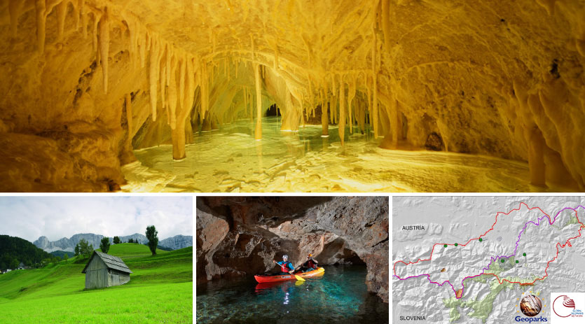
Podzemlje Pece, Glančnik 8, 2832 Mežica
Telephone
+386 (0)2 870 01 80Website
http://www.geopark.si/Do you know what’s hidden in the ground you’re walking on?
On the highest peaks of Karavanke you can find remnants of sea snails, sea lilies and even ichthyosaurs bones, all of which are evidence of the rich marine life that flourished in the ancient Tethys Ocean. Millions of years ago, sediment rocks started forming at the bottom of this ocean and these rocks now form the majority of the surface in the Karavanke geopark. In the past, the Smrekovec underwater volcano erupted here, and the Adriatic and the Eurasian plates joined at the sea bottom, lifting a mass of rock that today forms one of the world’s longest mountain ranges: the Alps.
A consequence of the two plates colliding is a several-hundred-kilometre long Periadriatic fault zone that crosses the Karavanke geopark and reaches deep into its underground. The Karavanke geopark also boasts wonderful minerals that are rare elsewhere, for example: orange wulfenite, brown dravite, white calcite, silver galenite, the often-overlooked sphalerite as well as mercury. Some of them used to be won as ore under the slopes of the Peca/Petzen and Hochobir/Obir mountains; today we can admire them in museums.
The surface as we see it today has been shaped by millions of years; for example, powerful natural forces formed the extraordinary karst caves of the Hochobir/Obir. The landscape was overgrown by the unique plants, like the Zois’ Bellfl ower, carnivorous sundew and gentian. Last but not least, the local people have been living with nature in such a way that all these secrets can be discovered again and again by future generations ...
Geopark Karavanke/Karawanken is a member of European and Global Geoparks Network created under the auspices of UNESCO.
Kontakt
- E-Mail: Ta e-poštni naslov je zaščiten proti smetenju. Za ogled potrebujete Javascript, da si jo ogledate.